Buffalo Bill Dam and Visitor Center: the Reservoir, the Canyon and Where the Photos Are
Published
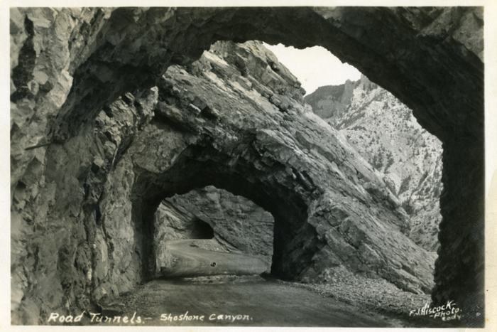
Six miles west of Cody the road to Yellowstone runs out of valley and Buffalo Bill Reservoir ends at a wall. The Shoshone River has cut a gorge through Precambrian granite here, and the highway has to tunnel through the canyon wall to get past it. Three tunnels, in fact, driven in 1960, the longest of them 3,300 feet. In that narrow throat sits Buffalo Bill Dam, a concrete arch completed in 1910 that stood 325 feet above the canyon floor and was, at the moment it was finished, the tallest dam in the world.
Why Buffalo Bill Dam is here
The engineering logic is visible from the road, which is unusual and is most of the appeal. A dam is cheapest where the valley is narrowest, because the wall you have to build is shortest there. Shoshone Canyon offers an extreme version of that: a slot of Archean granite and gneiss barely wide enough for the river, with sound walls on both sides to take the thrust of an arch.
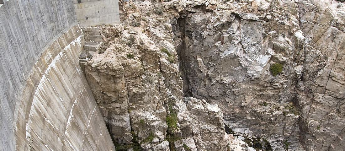
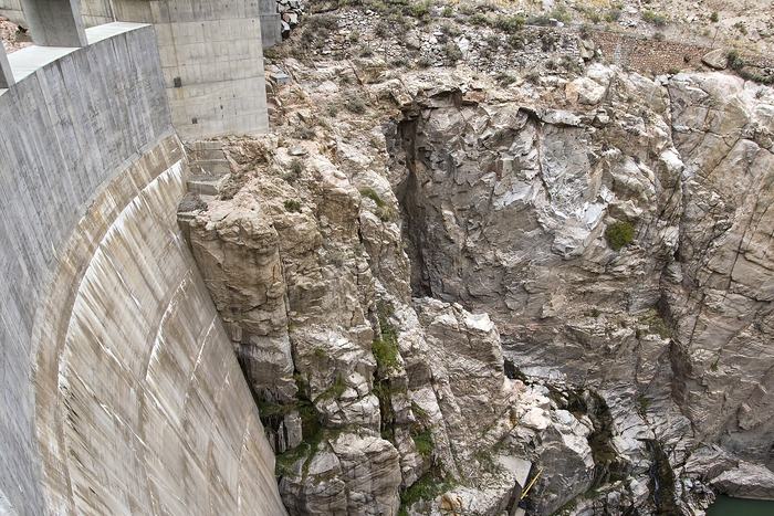
The consequence is a structure that does not look like most dams. There is no broad sweep of concrete across a wide valley floor. It is wedged between two rock faces, tall and narrow, and from downstream it reads more like a wall dropped into a crack than a piece of civil infrastructure sitting in a landscape.
It was one of the first jobs the newly created US Reclamation Service took on, built between 1904 and 1910 at a cost of around $1.4 million, and it was the first mass concrete dam in the country.
The Buffalo Bill Dam visitor center, and the view down
The Buffalo Bill Dam visitor center is built out over the downstream face, and the view people remember is the one straight down. Looking upstream you see the reservoir, which is pleasant enough and not remarkable. Looking down you get the full height of the arch, the canyon walls closing in, and the river running out below.
It sits directly on the road between Cody and the Yellowstone East Entrance, so the only real decision is whether to pull in. Twenty minutes covers the viewing platforms; an hour does the Buffalo Bill Dam visitor center properly.
Immediately west the road comes out of the canyon into open water and then into Wapiti Valley, and the change is abrupt enough to feel deliberate. Traveling east the same transition runs in reverse: the valley narrows, the tunnels arrive, and the basin opens out below on the far side.
Buffalo Bill Reservoir
Behind the dam the water backs up into the valley and opens out as Buffalo Bill Reservoir. Its purpose is irrigation. The Bighorn Basin is dry country, and the reservoir is what makes farming across a large part of it possible; that agricultural function is why the dam exists at all, and it remains why it matters locally.
For visitors it is a recreation area. Between the dam and Wapiti the shoreline carries a state park, boat access and several campgrounds. This is high desert reservoir and not mountain lake: open, exposed and frequently windy in the afternoon, which matters far more to boaters than to anyone stopping for the view. Anglers work both Buffalo Bill Reservoir and the river below the arch, and the two are quite different propositions.
The reservoir also marks a transition in the drive. East of it you are in basin country. West of it you are climbing toward the mountains, and the character of the road changes accordingly.
Photos: why it is a difficult subject
The dam is a genuinely difficult subject, which is worth knowing before you arrive expecting easy photos. The gorge is deep and narrow, so for much of the day one wall is in hard sunlight and the other is in deep shade, and the range between them is more than a camera handles well. Early and late are much kinder.
The strongest photos generally use the canyon walls as framing and accept the dam as a small element inside them, because the scale of the site is the subject and the structure is not.
The name
The dam was built as the Shoshone Dam and carried that name until 1946, when it was renamed for Buffalo Bill Cody, who had promoted irrigation in the basin and whose name is attached to a great deal in this part of Wyoming. Older maps and older photographs frequently use the original, and locally it is often just the Cody dam. All three point at the same structure.
- North rim 5,560 ft · m 0
- Wall 5,180 ft · m 26
- Riverbed 4,980 ft · m 50
- Wall 5,210 ft · m 74
- South rim 5,570 ft · m 100
Common questions
Was Buffalo Bill Dam really the tallest dam in the world?
Yes. At 325 feet above the canyon floor it was the tallest in the world when it was completed in 1910, taking the record from the Croton Dam in New York. It held it only briefly, because dam engineering moved quickly in the following decades, but the claim is accurate for its moment.
Where is Buffalo Bill Dam?
About six miles west of Cody on the road toward Yellowstone, inside Shoshone Canyon. The highway passes through three tunnels to reach it, which is the clearest sign you are arriving.
How long should you allow for the visitor center?
Twenty minutes covers the viewing platforms, which is what most people stop for. An hour does the exhibits properly. It sits directly on the route west, so there is no detour either way.
Why is it called Cody Dam on some maps?
Local usage. It was originally the Shoshone Dam, is officially named for Buffalo Bill Cody, and is often called the Cody dam simply because of where it is.