Hiking Near Cody, Wyoming: Cody Peak, the Absaroka Front and the Shoshone Forest Trails
Published
- In town
- Paul Stock loop, 2.1 mi
- First trailhead
- Four Bear, 17 mi west
- Forest
- Shoshone NF
- Country
- Bear
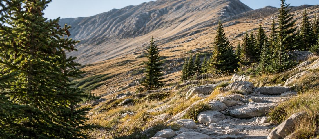
The mountain front west of Cody is the beginning of the Absaroka Range, and behind it sits Shoshone National Forest, the first federally protected national forest in the United States. There is a great deal of walking here. Very little of it is signposted from town.
Two loops you can walk from town
The Paul Stock Nature Trail is a 2.1-mile loop along the Shoshone, reached in about five minutes from downtown off River View Drive. It is flat, easy, walkable in under an hour, and it is the one genuinely casual walk in Cody: river, cottonwoods, prickly pear in bloom in early summer.
Beck Lake and the ground above it at Airport Ridge are the other in-town option. A paved path circles the lake, with restrooms and a dog park at it, and a network of dirt trails runs up onto the ridge behind. Routes there can be put together anywhere between one mile and ten, which makes it the most flexible walking near the middle of town.
Cedar Mountain, which locals also call Spirit Mountain, is the bigger one at the edge of town: roughly 6.2 miles with about 1,640 feet of climb, which puts it at moderate. Most of its trails run through the gullies or across the face, and those are noticeably more sheltered than the road up it, which matters on a windy day. Cedar Mountain forms the south wall of Shoshone Canyon, with Rattlesnake Mountain facing it across the river and the dam wedged between them. High near its summit, about four miles from town, is Spirit Mountain Cave, which Taft proclaimed Shoshone Cavern National Monument in September 1909 and Congress abolished in March 1954, making it the only national monument Wyoming has ever had taken away again. The BLM controls the entrance now and going in needs a permit. It is a thing on the mountain, not a thing to do there.
The trailheads up the North Fork
Everything else begins with a drive west on US 14/16/20, and the distances are worth knowing before you commit an afternoon.
Four Bear Trailhead is the closest at 17 miles from town. The trail climbs roughly four miles north to the Shoshone National Forest boundary, where it meets the wider network, and it is open to horses and limited mountain biking as well as walkers. It sits on BLM ground, not forest, which is why it is often missed on forest maps.
Elk Fork is about 29 miles out, at the campground of the same name, 9.8 miles west of the North Fork Shoshone River bridge. This is the standard way into the North Absaroka Wilderness and the trailhead where day walking turns into something longer.
The Blackwater Fire Memorial Trail leaves the highway about 38 miles west, near Blackwater Lodge. It is a National Recreation Trail and it is not a scenic loop: six miles up Blackwater Creek, it reaches two stone monuments built by the Civilian Conservation Corps at the places where fifteen firefighters died in the Blackwater fire of August 1937. That fire killed men from the Forest Service, the CCC and the Wyoming Bureau of Public Roads on the west slopes of Clayton Mountain, and the investigation that followed it fed directly into the creation of the smokejumpers. It is the most serious piece of ground on this list and the least visited.
Further on, at 50 miles, the North Fork trailhead near Pahaska Tepee has proper parking and puts you within a few miles of the park boundary. Bridal Veil Falls is the shortest worthwhile walk in the upper valley at 3.9 miles out and back, about two hours.
Where Cody Peak actually is
Cody Peak is not the summit on the skyline behind town, which is what its name leads most visitors to assume. It stands 50 miles west at Yellowstone’s East Entrance, the north sentinel of the gate, and its summit is a pyramid of steep volcanic rock columns. Everyone driving into the park passes underneath it and almost nobody looks up at it.
There is no maintained trail to the top. The two documented approaches both involve leaving the road: north from Pahaska on service roads to the Crow Creek trail, then three miles west before bushwhacking south to the north ridge; or east of the park gate along a power line, through brush and scree to an andesite cliff band. Both are loose, both are in grizzly country, and neither belongs on an itinerary that also includes dinner in town.
The forest is the reason, and it is not a park
Shoshone National Forest was set aside on 30 March 1891 as the Yellowstone Timberland Reserve, the first ground protected under the Forest Reserve Act, and the whole national forest system followed from it. It now runs to roughly 2.4 million acres along Yellowstone’s eastern boundary.
The practical consequence for a walker is scale. This is not a park with a visitor trail network and a ranger at the head of it. Behind the front, the North Absaroka Wilderness covers around 350,000 acres, designated in 1964 and deliberately left alone. There are roughly two hundred miles of trail in it, and the Forest Service’s own description is unusually frank: rough, minimally marked, long, steep, and inclined to follow drainages with nowhere to cross except near their heads. Getting lost there is a normal outcome, not an unlikely one.
The season is shorter than the calendar
Snow decides the walking here, not the date. The valley floor clears early and the high trails do not, so a route that is a straightforward day in August can be under snow at its top end well into summer. The country beyond Dead Indian Pass holds it longest.
Autumn is the quiet reward. The weather steadies, traffic on the park road thins, and the first snow of the season settles on the high summits weeks before it reaches the trails at Four Bear or Beck Lake, which stay walkable long after the tourists have gone.
Two things hold whatever the season. Altitude starts at 5,016 feet in town and only goes up, which is why arriving from sea level and walking hard on day one spoils day two. And storms build over the range through summer afternoons, fast, so the early start is a local habit for a reason.
Common questions
Is there a trail to the top of Cody Peak?
No maintained one. The two known approaches both leave the road and involve several miles of route-finding and bushwhacking through grizzly country, one from Crow Creek near Pahaska and one from the power line east of the park gate. It is a climb, not a day hike.
Where can you walk without driving out of Cody?
The Paul Stock Nature Trail, a 2.1-mile loop by the river about five minutes from downtown off River View Drive, and the paths around Beck Lake and Airport Ridge, where you can put together anything from one mile to ten.
Do you need bear spray hiking near Cody?
Yes, and it should be on your belt where you can reach it, not buried in your pack. This is grizzly range, not just black bear range, and the Forest Service treats food handling and noise in thick brush as baseline practice here.
Are the high trails near Cody open all summer?
Not reliably. Snow decides the walking here rather than the date. The valley floor clears early and the high ground does not, so a route that is a straightforward day in August can still be under snow at its top end well into the summer. The country beyond Dead Indian Pass holds it longest.