Wapiti Wyoming: the Wapiti Valley, its Lodges, Campgrounds and the North Fork Road
Published
- Reservoir head 5,370 ft · mi 0
- Wapiti 5,600 ft · mi 12
- Upper valley 6,200 ft · mi 30
- Pahaska Tepee 6,600 ft · mi 44
- East Entrance 6,951 ft · mi 46
Wapiti Valley Wyoming, Wapiti Wyoming on the road signs, is the stretch west of Buffalo Bill Reservoir where the country opens again and the road follows the North Fork of the Shoshone River for the better part of forty miles to the Yellowstone boundary. It is the reason the drive from Cody to the East Entrance has the reputation it does.
There is no town to arrive at
The first thing to understand about Wapiti Wyoming is that it is not a settlement in the way the name on a map suggests. There is a post office, a school and a scattering of ranches, lodges and houses spread along fifty miles of river. Arriving is not an event. You are in it for half an hour before you notice.
That stops being a disappointment as soon as you expect it. There is no museum in Wapiti Valley Wyoming, no visitor center and no organized sight. What there is: forty miles of river, volcanic rock, elk on the flats at dusk, and the last stretch of ordinary landscape before the park boundary changes the rules. Wapiti Wyoming is a valley with a postal name, and that is the whole of it.
Driving into Wapiti Wyoming
The route is US-14/16/20 and it climbs steadily the whole way. The lower valley is broad and agricultural, with the river close to the road and the Absaroka front standing up on both sides. Further west the valley narrows and the volcanic rock begins.
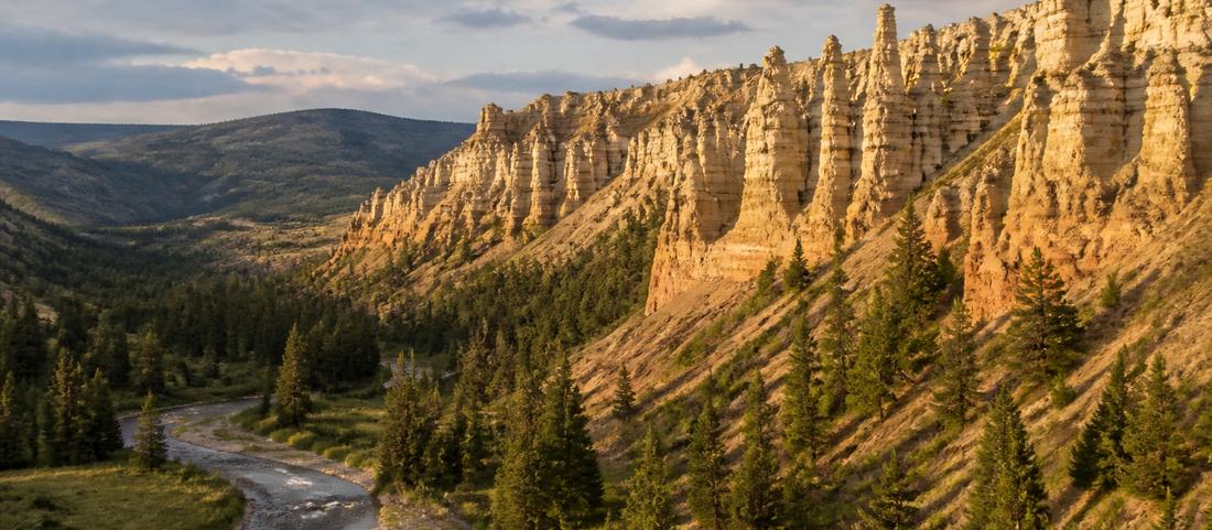
Those formations are the signature. The Absarokas are volcanic in origin and the softer material has eroded into spires, hoodoos and blocks along the upper valley, some of which carry names and most of which do not. They are best in low light, when the shapes separate from the hillside behind them.
The drive is slow by nature. Between the speed limit, the wildlife on the verges and the frequent reasons to stop, the fifty-two miles from Cody to the gate takes well over an hour. Planning it at highway speed is the most common mistake visitors make here.
Wildlife
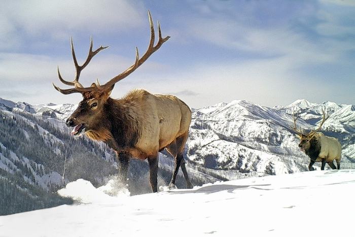
The name is the Shawnee word for elk and the valley earns it. Elk move through with the season and are most visible early and late. Bighorn sheep work the rock faces, mule deer are common on the lower slopes, and this is bear country, both black and grizzly, with all the ordinary precautions that implies for anyone leaving the car for more than a photograph.
The verges are where the risk sits. Animals cross at dawn and dusk, which are precisely the hours when the light is best and the temptation to drive quickly between viewpoints is highest.
The Smith Mansion
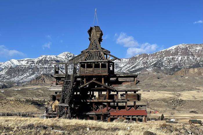
One structure in the valley stops almost every car that passes it. The Smith Mansion is a tall, irregular timber house built by hand over many years from local material, rising in stacked stories and open balconies well above the treeline of the valley floor. It is unlike anything else on the road.
It is private and not a formal attraction, which is worth stating plainly: people photograph it from the roadside and do not visit it. As a landmark it works as the valley’s unofficial midpoint, and it is the single most recognizable thing between the reservoir and the park gate.
Lodges and campgrounds along the North Fork
Lodges, guest ranches and forest campgrounds are strung along the river, and they add up to a genuinely different visit from staying in Cody. A Wapiti lodge Wyoming address means somewhere on this road, not in a settlement, and every Wapiti campground Wyoming listing works the same way: the postal name is the valley. From the upper end the park gate is within half an hour, which is what makes an early start into Yellowstone realistic instead of theoretical.
The trade is everything else. Restaurants, the museum complex and the rodeo are all back in town, an hour each way, so most valley lodges feed their own guests and evenings are spent where you are staying. For some visitors that is the entire appeal. For others it is the reason to stay in Cody and drive out.
Between the two, a Wapiti lodge Wyoming stay buys comfort and a cooked meal. A Wapiti campground Wyoming site trades both for a much darker sky at the same distance from the gate, and the campgrounds nearest the boundary are hard-sided only.
Driving it in each direction
Westbound in the morning the light is behind you and the rock formations of the upper valley are lit directly, which is the better direction for photographs. Eastbound in the evening you get the Absaroka front lit from the side and the basin opening out ahead, which is the better direction for the view.
Anyone driving to Yellowstone and back covers both in a day. If you are only making the trip once, the late return is generally the more memorable half.
Common questions
Where is Wapiti, Wyoming?
A valley and a scattered community along the North Fork of the Shoshone River, running west from Buffalo Bill Reservoir toward Yellowstone's East Entrance. The post office is roughly eighteen miles west of Cody, and there is no town center in the usual sense.
What does Wapiti mean?
It is the Shawnee word for elk. The valley carries the name because of the elk that winter and move through it, and the animal remains the one most visitors hope to see from the road.
Are there places to stay in Wapiti Valley?
Yes. Guest lodges, dude ranches and forest campgrounds are spread along the North Fork road. Staying here puts you much closer to the park gate but a long way from Cody's restaurants and museums.
Is there a campground in Wapiti?
Several, mostly national forest sites strung along the river between the reservoir and the park boundary. Big Game, Wapiti and Elk Fork sit around 29 miles from Cody; Rex Hale, Eagle Creek and Threemile are further up. All are simpler than the commercial parks in Cody and much better placed for an early start into Yellowstone.